
Shikoku Henro Bus & Train shortcut pins my map
- Digital1,500 JPY
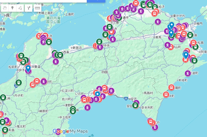
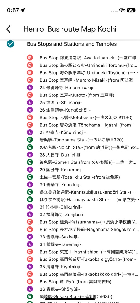
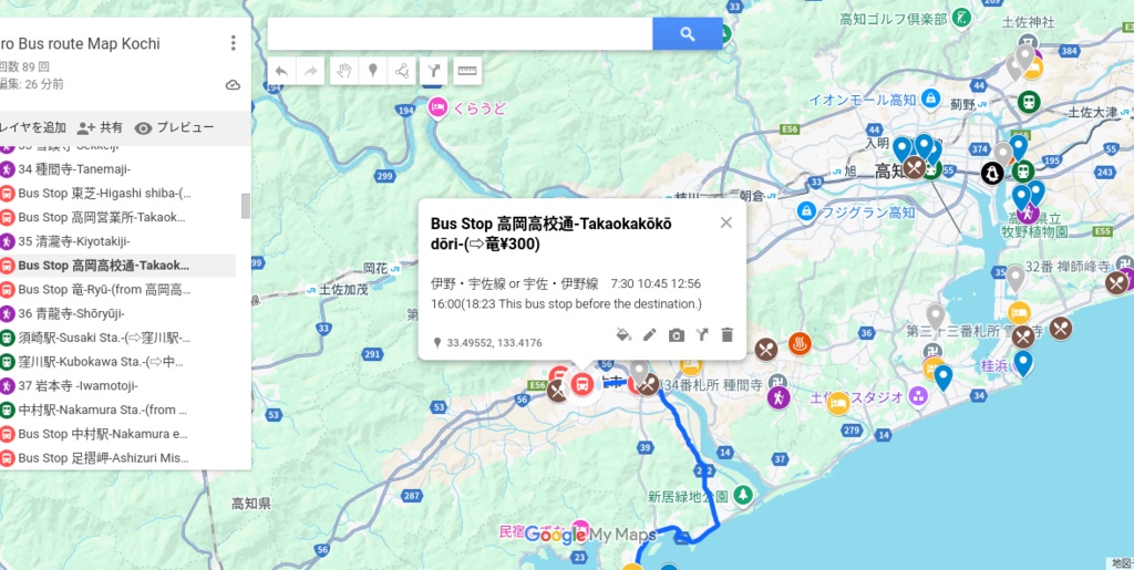
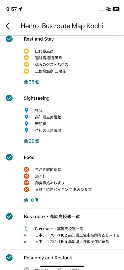
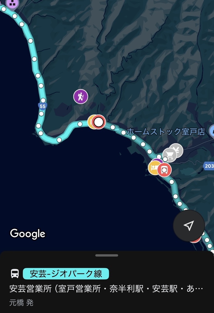
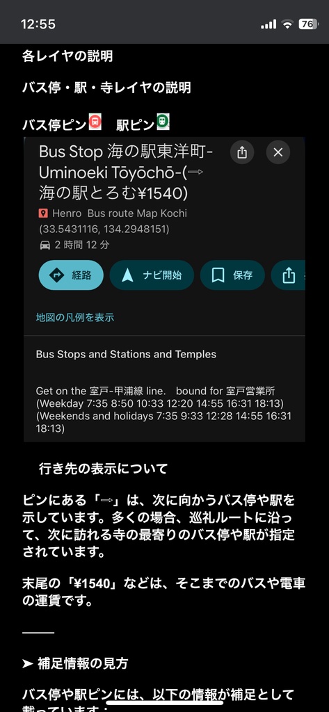
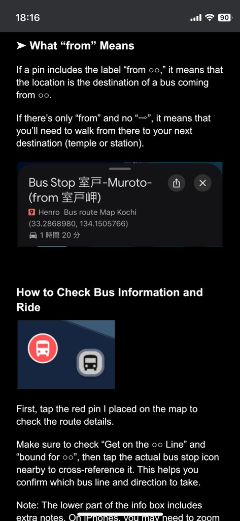
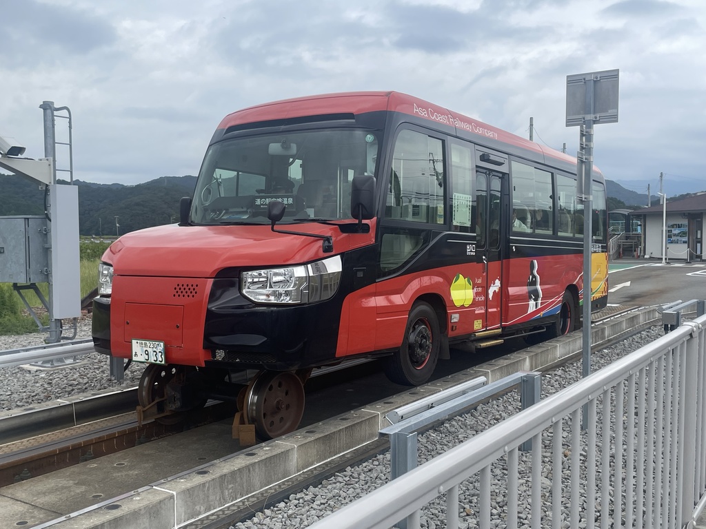
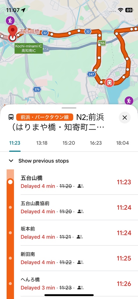
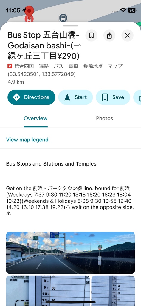


◉ 四国遍路 × 公共交通 Shikoku Pilgrimage × Public Transport 車なし巡礼者向けルートマップ (PDF+Googleマップ連携) Route Map for Pilgrims without a Car (PDF + Google Maps Integration) ⸻ 概要 Overview 四国遍路をバス・電車で巡る方向けに、Googleマップアプリのマイマップ機能を活用したルートマップを作成しました。 This is a route map designed for those who wish to complete the Shikoku Pilgrimage using public transportation (buses and trains). 車なし・徒歩ベースで移動する方のために、バスや電車の接続・運賃・札所を一つの地図にまとめ、アプリ上で直感的に確認できるよう工夫しています。 Using the Google Maps “custom map” feature, this map helps car-free travelers navigate bus or train connections, fares, and temples — all in one place. Optimized for intuitive use directly within the Google Maps app on your phone. ⸻ 本マップでできること What This Map Helps You Do • 四国遍路におけるバス・電車の最短接続を一目で把握 • Instantly grasp the most efficient bus/train connections for each temple area • 次に向かうべき札所の最寄りバス停・駅が地図上ですぐ分かる • Quickly find the nearest bus stop or station to the next temple • バスの時刻・運賃・行き先・写真付解説で迷いにくい • Access timetables, fares, destinations, and photo-based guidance • Googleマップ連携で、スマホからすぐに使える • Use directly from your smartphone via Google Maps integration ⸻ こんな方におすすめ Who It’s For • 無駄な出費・遠回り・過剰な荷物を減らし、身軽に四国遍路を巡りたい方 •those who want to reduce unnecessary costs, detours, and excess luggage, and travel the Shikoku pilgrimage light and efficiently. ⸻ ■ DMV体験ルートを収録 / Includes Rare DMV Ride Experience 世界初の鉄道×バス両用車両「DMV(デュアルモードビークル)」を活用した巡礼ルートを収録。 The map includes a special route using the world’s first Dual Mode Vehicle (DMV), which runs as both a train and a bus. 内容物 Included in This Product • PDFファイル(日本語解説+英語解説) • PDF file (with both Japanese ver. &English ver. explanations) • Googleマップ共有リンク(マップ上ですぐ使える) • Shareable Google Maps link (ready to use) ⸻ ⚠ 注意事項 ⚠ Important Notes •このマップは、購入者の方への信頼のもとお渡ししています。 お連れの方とご一緒に使うことは構いませんが、転載や配布はお控えください。 • This map is shared with you based on trust as a purchaser. You’re welcome to use it together with a travel companion,but please refrain from reposting or redistributing it. • 本マップは個人による現地調査・制作の非公式資料です。 • This map is an unofficial guide, created independently through on-site research • 時刻や運賃は可能な限り正確を期していますが、 誤りや改定がある可能性もあります。 • Timetables and fares are provided with care but may change or include errors • 実際に乗る前に、Googleマップ上のバス停や駅のアイコンをタップするか、現地の時刻表で最新の運行情報を必ず確認してください。 • Always check the latest schedule by tapping bus or station icons on Google Maps, or at local displays before boarding. •本マップは英語圏の方にわかりやすいように作られています。 • This map is designed to be easy to understand for English speakers. •観光レイヤ、供給品レイヤ、飲食店レイヤ等はまだ試作段階で、内容も不完全です。今後アップデートしていく予定ではありますが、現時点ではあくまでおまけ的な位置づけとしてご利用ください。 • The sightseeing, resupply & restock, and food layers are still experimental and not yet complete. They may be updated later, so for now please think of them as bonus content. ファイル形式 File Format • PDF(スマホで読みやすい縦型構成) • PDF (mobile-friendly vertical layout)